blah blah blah
The Basin
Length: 0.8 miles out-and-backDifficulty (click for info): Beginner
Elevation Gain: 0 feet (+120 feet on return)
Rating (click for info): 8/10
Source: Pemigewasset River
Driving Directions:
Trailhead and parking area are on I-93 in Lincoln, NH. There are two parking areas available for the Basin, one for each lane of interstate 93. For the northbound lane, it is 2.1 miles past exit 34A (Rt. 3/The Flume), and for the southbound lane, it is 1.2 miles past the Lafayette Place Campground. Both sides are clearly marked with signs for The Basin. On the northbound side, you will have to walk the path under the pedestrian tunnel, which begins near the entrance. The two access points are at opposite ends of the short paved walking path which tours the cascades around The Basin. Click here for a Google map.
About the Hike:
The Basin is one of the most iconic scenic destinations in the White Mountains. It's a must-stop for anyone traveling through Franconia Notch for the first time and worthy of repeated respects from locals. The nascent Pemigewasset River forms a delightful array of powerful cascades on its journey out of the notch. With more force and volume than a typical mountain stream, the river has worn away the bedrock into a fascinating assorment of chutes and pools that have made it a treasured attraction for state residents and visitors alike. Viewing the Basin requires little effort, only a brief jaunt down a series of paved and gravel walking paths provding ample viewing opportunities of the waterfalls. The only difficulty is avoiding the crowds, owing to its heavy notoriety as a scenic attraction. The best time to make your visit is in winter or spring, away from the holidays and summer tourist season.
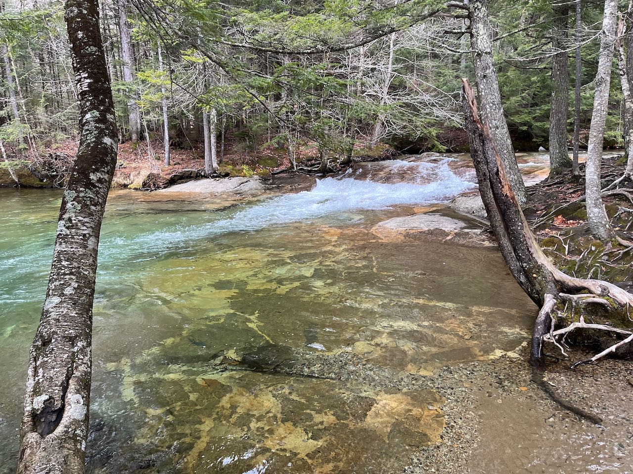
If you parked at the southbound entrance, begin your walk at the south end of the pull-off near the wooden fence. Walk 250 feet downhill and head straight across the bike path. If you parked at the northbound entrance, start at the end of the parking area closer to the off-ramp and follow the bike path through the tunnel under the highway. Stay on the bike path for a quarter mile, passing two diverging entrances toward the Basin on the left, until you reach the path coming down from the southbound entrance. Take a left here and continue following as described. Distance is given from the southbound entrance. It is slightly longer from the northbound one. The path on joins up with the river and follows it along a mellow section just ahead of the chaotic rapids. You'll soon approach a deep pool in the riverbed with a stunning green-blue tinge and an interesting mottled rock pattern at the bottom. 300 feet further, bear right onto a gravel path as a paved path leads back out to the bike trail (this is used for wheelchair-accessible viewing of the Basin).
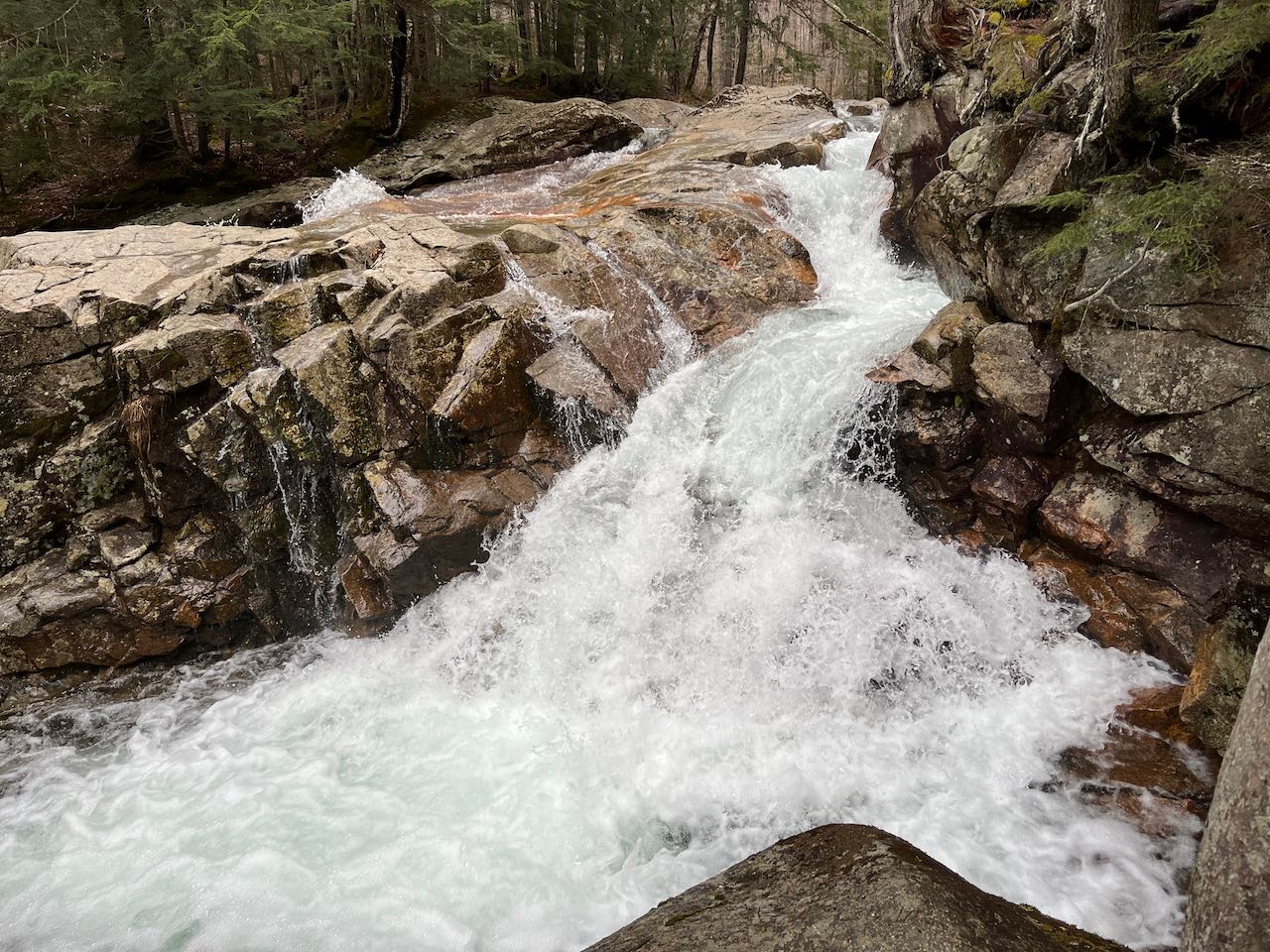
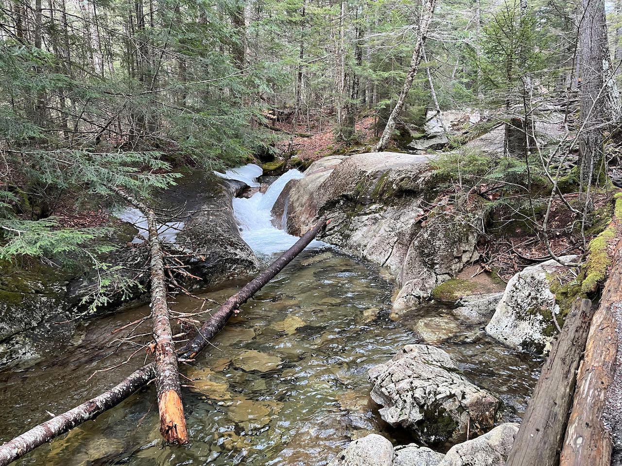
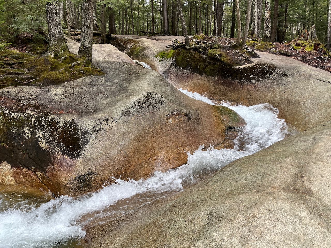
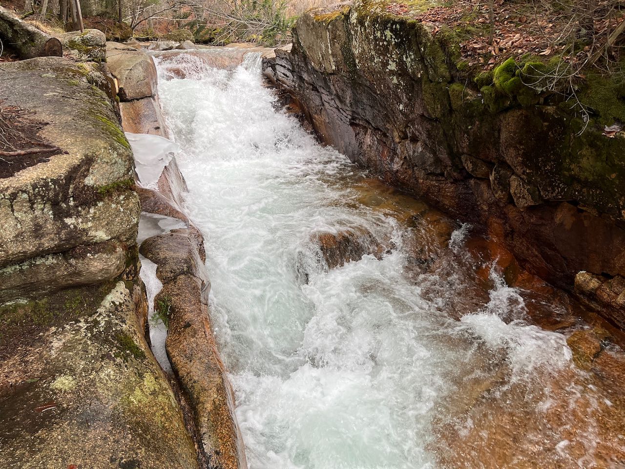
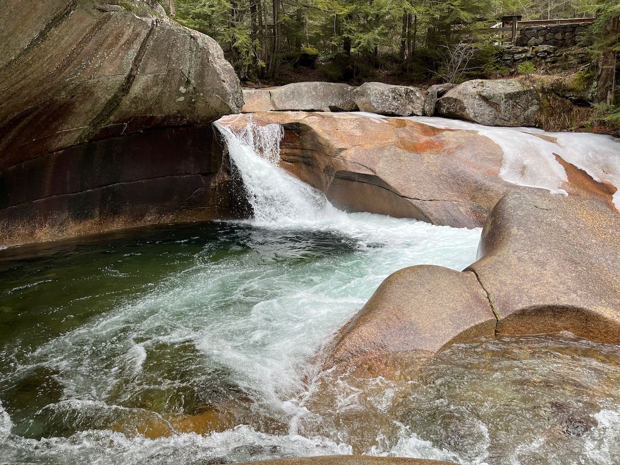
Crossing the bridge, the first truly impressive waterfall will be on your right. The torrent of water crashes through a hollow in the rock and empties out over a choppy ledge. The river splits here, and the path proceeds onto an island of sorts, following the right branch. Passing a short cascade with the appearance of a water bubbler, the path zigzags downhill along a smooth ledge with a winding half-pipe carved into it where the water flow snakes down through the rock. You can walk out onto the ledge to approach the whimsical miniature canyon. The path then meanders down past a few more small cascades to reach a side path on the left, 350 feet from the bridge. Walk down the stairs here to arrive at the fenced-in viewing area for the main attraction - The Basin itself. It's one of the northeast's more unique waterfalls. Here, the river pours over a ledge at an angle and circulates in a huge bowl underneath an overhanging rock. You'll want to linger here and capture the scene that millions of other visitors have photographed. Many visitors turn around here, but it's worth continuing your walk to see the last natural feature, the Baby Flume. Walk another 250 feet down the main trail, over another bridge and past the trailhead for Basin-Cascades Trail, to a point where the tourist path takes a left and crosses a bridge back to the bike path. If you parked on the northbound side, you will cross this bridge on your way back. But first, turn right onto the Pemi Trail, a much narrower footpath through the woods. Stroll gently downhill along the river for 0.15 miles until you come to the head of the short gorge, where the water is funneled into a channel between two rock walls of similar height. You can observe it from above and below. The Pemi Trail continues downstream, where the activity in the river ceases. You can turn around here.
Printable directions page